Skip to content
SYS checking…

LIVE · indicators
Research lines6active programmes
Open repositories5on GitHub
Partner organisations4universities and institutes
Projects under way11across three lines
Datasets3openly available
Peer-reviewed papers4in preparation
Events held7seminars and colloquia
Pages of documentation240open knowledge base
Research lines6active programmes
Open repositories5on GitHub
Partner organisations4universities and institutes
Projects under way11across three lines
Datasets3openly available
Peer-reviewed papers4in preparation
Events held7seminars and colloquia
Pages of documentation240open knowledge base
Projects

Projects of the institute

For us a project is a research question carried all the way to a working tool. Not a technology demo, not a prototype built to be shown: every project is assembled so that its result can be verified, reproduced and used without us — on open data, open models and open licences.

1project in progress
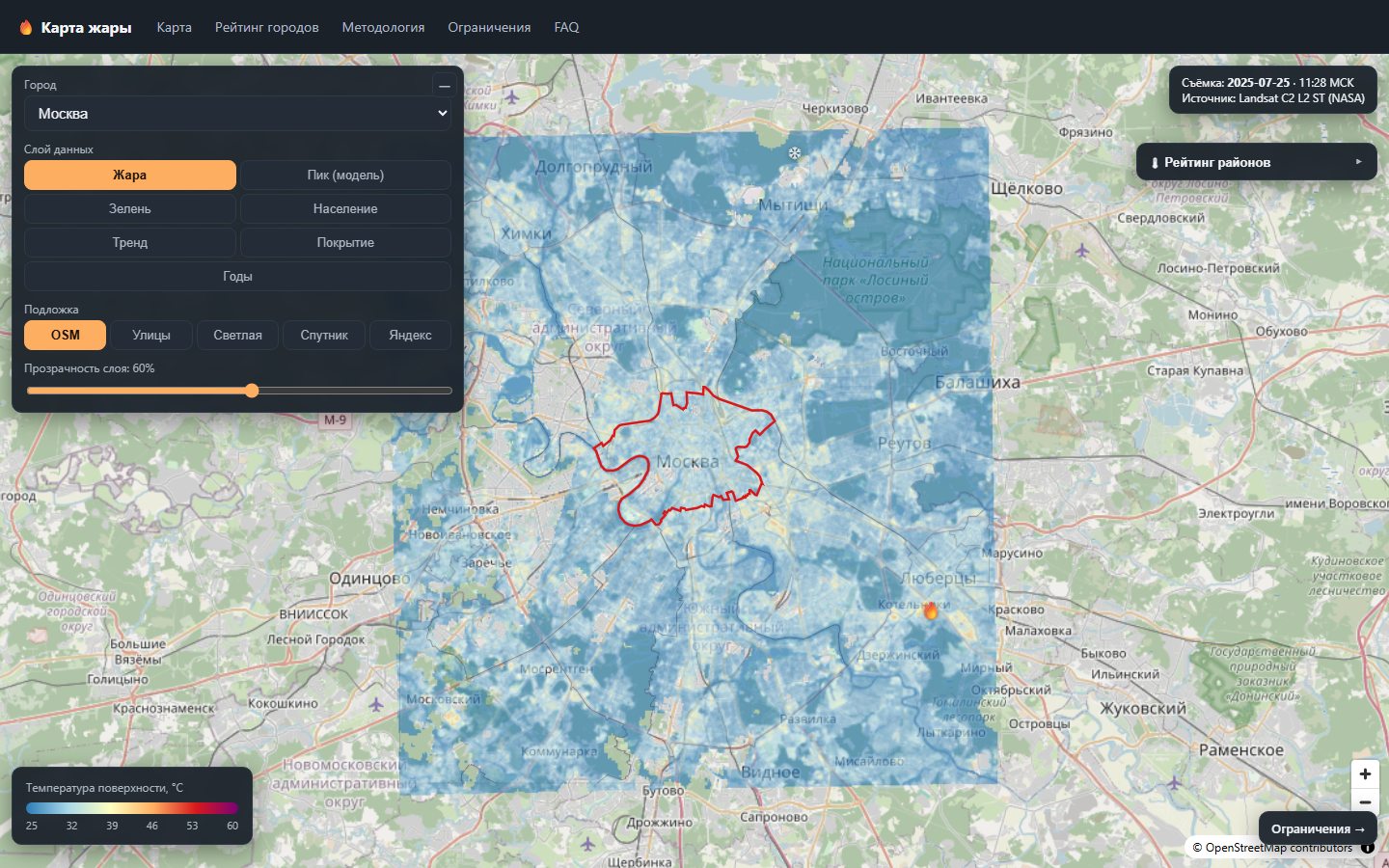
The Heat Map interface: the land surface temperature layer over Moscow, with the layer panel and temperature scale
activeworking build · preparing for public release

Heat Map

A public map of urban heat islands across Russia: land surface temperature at 30-metre resolution, built entirely from open satellite data.

Cities
10
Resolution
30 m
Observations
2015–2025
Data layers
7
Applied machine perception · geospatial analysis of the urban environmentPython · rasterio / pyproj · PMTiles · Next.js · MapLibre GL
Open the project →